

LOCAL HISTORY
Kirkland once destined to be a big steel town. What happened?
Before the bridges, ferries linked the Eastside and Seattle.

Our homesites were under water before they lowered the lake.

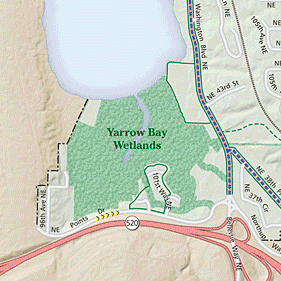
THE WETLANDS

The recent history of what is now the Yarrow Bay Wetlands really starts about 20,000 years ago when glacial ice from the last ice age covered this land. The ice was as much as 5,000 feet thick, and it changed the land in two ways. It scoured out a depression that became Lake Washington, and about 12,000 years ago it started to melt which caused massive erosion. It was the melt water from the glacier that was largely responsible for the silt in Yarrow Bay.
Prior to 1916, the wetlands surrounding the POYB and the ground where our homes sit was under water. This entire area was a shallow water bay with deep silty deposits. In 1916, with the completion of the Ballard locks and the Montlake cut, boats could travel from the salt water of Puget Sound into Lake Union and on through the cut into Lake Washington. Because the two lakes were of different heights, the opening of the Montlake cut lowered the level of Lake Washington by 9 feet. After the lake was lowered this area was a mud bog, however, the deep silt deposits contained top soil that had eroded from the surrounding hills.
It did not take long for people to recognize that this fertile and unclaimed land could produce bountiful food crops. A few families of enterprising Japanese immigrants staked out small gardens and began growing produce which was sold in local markets. However, much of this new land was too water logged for growing vegetables because it was flat and did not drain well. To solve the problem, the farmers dug trenches around their gardens to drain off excessive water. These trenches were 2 or 3 feet wide and 2 to 4 feet deep and they extended to Lake Washington. These trenches are still in place in the wetlands, heavily overgrown and often hidden by the abundant vegetation. If you use Google Earth and look at the wetland on the North and the West side of the complex you can see some very faint lines that are the faint traces of the drainage trenches from long ago.
Two decades later, thousands of Japanese Americans living in the United States were forced into war relocation camps in 1942 and thus the agricultural use of Yarrow Bay came to an end. The land quickly became overgrown, and the wetlands soon looked much like it does today. Then in 1960, the State awarded a contract to Guy F. Atkinson Construction Company to build the Evergreen Point Bridge. One of the first actions taken by the Atkinson Construction Co. was to back fill 10 acres of what at the time was viewed as worthless wetlands. This back fill was comprised of clay and gravel and was used to stabilize the marshy ground. The company then used the 10 acres as a construction staging area for all manner of equipment and materials until the bridge was completed and opened for use in August of 1963. The company then abandoned the construction staging area.
The back filling of the wetland forever changed the future use of the area: while it effectively destroyed wetlands, it created 10 acres of potentially developable land.
THE POINT on YARROW BAY


The first plan for development of the property (late 1960s or 1970's) was for a shopping center. That plan was abandoned in its early stages. The family that owned the property pursued several other options for development. Numerous hindrances stood in the way, including the possibilities of Native American rights to ownership.
The first plans for residential development began in the 1980s, resulting in a collection of cul-de-sac homes. Those plans were abandoned, possibly due to a change in ownership or investors. SunCrest Homes, the POYB developer, purchased the land in 1989 and set about acquiring the necessary permits. Because this wetlands site was such a sensitive area on which to build, it took them several years to complete the process. Their plans were for what we see today plus a tenth building consisting of four units on the westernmost part of the property. Note: the POYB could never be replicated today given increased environmental protections.
In the early 1990s, construction began with a temporary bridge across Yarrow Creek where the vehicle bridge exists today. Fill was brought in and placed to a height of three feet or more over the areas where buildings were to be constructed. The purpose of the fill was to pre-load those areas for a period of three to six months or more, compressing the layer of peat that exists beneath the property. After the compression period, the fill was removed and piles were driven through the peat into stable strata. Concrete foundations were then constructed on top of the pilings.
The condominium was created in three phases of three buildings each. The legal description of the property refers to the buildings by numbers one through ten. At some point, the Association (controlled by the builder until July 1995) chose to refer to the buildings alphabetically; thus "A" through "I" with "J" (or number 10) on hold as a development right. Phase 1 consisted of buildings A, B, and C where the model homes and sales offices were located. Sales began in July 1994. Phase 2 consisted of buildings D,E, and F, and began selling in January 1995. Phase 3 consisted of buildings G,H, and I, and began selling in March 1995. The last unit to sell to an original owner was in October 1996.
The development rights to building 10 expired in 2004. The Board discovered that the developer had ceased paying the property taxes associated with the parcel and assumed the payments beginning in 2001 (about $75 per year). Once the development rights expired, the board acquired title to the property in the name of the Association and explored options to use or sell the parcel. Ultimately, the parcel was sold to the Washington Department of Transportation for $30,000 in 2009. The funds were deposited into the Association’s reserve account.
A construction note: because different crews were used during the project, and design changes were made as work progressed, not all units are exactly the same. Minor differences exist between units in one building compared to another.
WILDLIFE


One of the unique benefits of living at the POYB is being surrounded by a 73-acre wildlife conservancy area. The Yarrow Bay Wetlands which borders our community is home to a plethora of wildlife.
The Point on Yarrow Bay is now recognized by the National Wildlife Federation as a "Certified Wildlife Habitat site".
Here’s an incomplete species list of animals sharing our neighborhood.
Mammals:
Blacktail deer
Coyote
Bobcat
Beaver
Raccoon
River Otter
Western Gray Squirrel
Cottontail Rabbit
Opossum
Weasel
Mink
We also have assorted bats, mice, rats, moles, voles and reptiles such as turtles and garter snakes.

BIRDS
American Crow
American Goldfinch
American Robin
Anna’s Hummingbird
Bald Eagle
Band-tailed Pigeon
Barred Owl
Belted Kingfisher
Black-capped Chickadee
Black-Chinned Hummingbird
Black-headed Grosbeak
Brewer’s Blackbird
Brown-headed Cowbird
Bushtit
California Quail
Canada Goose
Cedar Waxwing
Chestnut-backed Chickadee
Common Raven
Cooper’s Hawk
Dark-eyed Junco
Downy Woodpecker
European Starling
Evening Grosbeak
Golden-crowned Sparrow
Great Blue Heron
Great horned Owl
Hairy Woodpecker
House Finch
House Sparrow
House Wren
Killdeer
Mallard Duck
Marsh Hawk
Northern Flicker
Northern Harrier
Osprey
Pileated Woodpecker
Pine Siskin
Purple Finch
Red-breasted Sapsucker
Red-tailed Hawk
Red-Winged Blackbird
Rock Pigeon
Rufous Hummingbird
Savannah Sparrow
Sharp-Shinned Hawk
Song Sparrow
Spotted Towhee
Steller’s Jay
Trail’s Flycatcher
Tree Swallow
Violet-green Swallow
Virginia Rail
Western Scrub-Jay
White-crowned Sparrow
There are many other species of birds that are not on the above list that are known to live in this area and/or in a wetland habitat or migrate through making short stops. However, these species have not been positively identified. Get out your bird, mammal and reptile identification books and your binoculars and add to the list!
Our thanks to Armistead Peyton and Don Muggli for historical input and Don for dedicated bird watching.